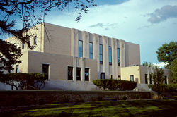
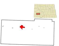
Dickinson, North Dakota
| Dickinson, North Dakota | |
|---|---|
| — City — | |
 |
|
| Nickname(s): Queen City[1] | |
 |
|
| Coordinates: | |
| Country | United States |
| State | North Dakota |
| County | Stark |
| Government | |
| - Type | City Commission |
| - President | Dennis Johnson |
| - City Administrator | Shawn Kessel |
| Area | |
| - Total | 9.5 sq mi (24.6 km2) |
| - Land | 9.5 sq mi (24.5 km2) |
| - Water | 0.0 sq mi (0.1 km2) |
| Elevation | 2,411 ft (735 m) |
| Population (2008) | |
| - Total | 16,035 |
| - Density | 1,690.7/sq mi (652.8/km2) |
| Time zone | Mountain (MST) (UTC-7) |
| - Summer (DST) | MDT (UTC-6) |
| ZIP codes | 58601-58602 |
| Area code(s) | 701 |
| FIPS code | 38-19620[2] |
| GNIS feature ID | 1028683[3] |
| Highways | I-94, I-94 Bus., ND 22 |
| Website | www.dickinsongov.com |
Dickinson is a city in Stark County, North Dakota, in the United States. It is the county seat of Stark County[4]. The population was 16,010 at the 2000 census. Dickinson was founded in 1882.
The local paper is The Dickinson Press. Theodore Roosevelt Regional Airport serves the city. Dickinson is home to Dickinson State University, bakery manufacturer and distributor Baker Boy, and cabinet manufacturer TMI.
Dickinson is the principal city of the Dickinson Micropolitan Statistical Area, a micropolitan area that covers Billings and Stark counties[5] and had a combined population of 23,524 at the 2000 census.[2]
Contents |
History
The city was named after Wells S. Dickinson, a railroad official.[6]
Geography
Dickinson is located at (46.883575, -102.788811).[7]
According to the United States Census Bureau, the city has a total area of 24.6 km2 (9.5 mi2). 24.5 km2 (9.5 mi2) of it is land and 0.1 km2 (0.04 mi2) of it (0.21%) is water.
Demographics
| Historical populations | |||
|---|---|---|---|
| Census | Pop. | %± | |
| 1900 | 2,076 |
|
|
| 1920 | 4,122 |
|
|
| 1930 | 5,025 | 21.9% | |
| 1940 | 5,839 | 16.2% | |
| 1950 | 7,469 | 27.9% | |
| 1960 | 9,971 | 33.5% | |
| 1970 | 12,405 | 24.4% | |
| 1980 | 15,974 | 28.8% | |
| 1990 | 16,097 | 0.8% | |
| 2000 | 16,010 | −0.5% | |
| Est. 2008 | 16,035 | 0.2% | |
As of the census[2] of 2000, there were 16,010 people, 6,517 households, and 4,020 families residing in the city. The population density was 652.7/km2 (1,690.7/mi2). There were 7,033 housing units at an average density of 286.7/km2 (742.7/mi2). The racial makeup of the city was 97.16% White, 0.27% African American, 1.20% Native American, 0.24% Asian, 0.03% Pacific Islander, 0.32% from other races, and 0.77% from two or more races. Hispanic or Latino of any race were 1.05% of the population.
The top 6 ancestry groups in the city are German (54.1%), Norwegian (14.2%), Czech (7.5%), Russian (7.2%), Irish (5.5%), English (3.7%).
There were 6,517 households out of which 30.9% had children under the age of 18 living with them, 49.7% were married couples living together, 9.1% had a female householder with no husband present, and 38.3% were non-families. 32.4% of all households were made up of individuals and 13.3% had someone living alone who was 65 years of age or older. The average household size was 2.33 and the average family size was 2.99.
In the city the population was spread out with 24.5% under the age of 18, 13.8% from 18 to 24, 25.9% from 25 to 44, 19.8% from 45 to 64, and 16.1% who were 65 years of age or older. The median age was 36 years. For every 100 females there were 93.5 males. For every 100 females age 18 and over, there were 88.7 males.
The median income for a household in the city was $31,542, and the median income for a family was $41,566. Males had a median income of $30,613 versus $19,951 for females. The per capita income for the city was $15,975. About 7.1% of families and 12.0% of the population were below the poverty line, including 10.2% of those under age 18 and 16.9% of those age 65 or over.
Climate
| Average Monthly High and Low Temperatures | |||||||||||||||||||||||||
| Month | Jan | Feb | Mar | Apr | May | Jun | Jul | Aug | Sep | Oct | Nov | Dec | |||||||||||||
|---|---|---|---|---|---|---|---|---|---|---|---|---|---|---|---|---|---|---|---|---|---|---|---|---|---|
| Norm High °F | 24 | 31 | 41 | 55 | 67 | 76 | 83 | 83 | 71 | 58 | 39 | 28 | |||||||||||||
| Norm Low °F | 0 | 7 | 16 | 28 | 40 | 49 | 53 | 52 | 40 | 29 | 15 | 4 | |||||||||||||
Education
K-12
Dickinson is served by the Dickinson Public Schools system which includes five elementary schools, a junior high school, Dickinson High School and an alternative high school. There are also several parochial schools in Dickinson. Trinity East and Trinity West serve as the parochial elementary schools and Dickinson Trinity has both a junior high school and a high school. Hope Christian Academy is also located in Dickinson.
Higher education
- Dickinson State University
Media
- The Dickinson Press
Television
Digital
- 2.1 KXMA/CBS (ATSC 19-3)
- 2.2 KBMY/ABC (ATSC 19-4)
- 2.3 KXMA/weather (ATSC 19-5)
- 7.1 KQCD/NBC
- 9.1 KDSE/PBS Prairie Public Broadcasting
- 9.2 KDSE/PBS same programming as 9.1, but in lower resolution for older televisions
- 9.3 KDSE/PBS Minnesota Channel
- 9.4 KDSE/PBS Lifelong Learning
- 38.1 KNDX/Fox
Radio
FM band
- 88.1 K201FN - rebroadcasts CSN (Christian)
- 89.9 KDPR - North Dakota Public Radio/NPR network (Public radio)
- 92.1 KZRX "Z92" (Album Oriented Rock)
- 99.1 KCAD "Roughrider Country" (Country)
- 103.3 KPAR-LP - low power broadcaster carrying LifeTalk Radio network (Christian Talk)
- 105.7 KDXN "Wild 105.7" (Country)
- 107.1 K296DT - rebroadcasts KSLT "K-Salt" (Cont. Christian music)
AM band
- 1230 KDIX "Real Country" (Oldies/Classic country)
- 1340 KPOK (Country/Talk)
- 1410 KDKT "Fox Sports Radio 1410" (Sports/Talk)
- 1460 KLTC (Classic country/Talk)
Sites of interest
- Dakota Dinosaur Museum
- Dickinson Museum Center
Sports
- Dickinson Roughriders of North Dakota American League Baseball
- Dickinson State University Blue Hawks
Notable residents
- Bennie Joppru - American football player
- Dorothy Stickney - Broadway actress
- Kellan Lutz - American actor-played Emmett Cullen in Twilight
- Ernest Viggo Almquist (1894 – 1962) - Commercial Artist
References
- ↑ "City of Dickinson, North Dakota". http://www.dickinsongov.com/. Retrieved 2010-04-20.
- ↑ 2.0 2.1 2.2 "American FactFinder". United States Census Bureau. http://factfinder.census.gov. Retrieved 2008-01-31.
- ↑ "US Board on Geographic Names". United States Geological Survey. 2007-10-25. http://geonames.usgs.gov. Retrieved 2008-01-31.
- ↑ "Find a County". National Association of Counties. http://www.naco.org/Template.cfm?Section=Find_a_County&Template=/cffiles/counties/usamap.cfm. Retrieved 2008-01-31.
- ↑ Micropolitan statistical areas and components, Office of Management and Budget, 2007-05-11. Accessed 2008-07-27.
- ↑ "Profile for Dickinson, North Dakota". ePodunk. http://www.epodunk.com/cgi-bin/genInfo.php?locIndex=52776. Retrieved 2010-06-21.
- ↑ "US Gazetteer files: 2000 and 1990". United States Census Bureau. 2005-05-03. http://www.census.gov/geo/www/gazetteer/gazette.html. Retrieved 2008-01-31.
- ↑ http://www.weather.com/weather/wxclimatology/monthly/graph/58601?from=tenDay_bottomnav_undeclared
External links
- City of Dickinson - official website
- Dickinson Convention and Visitor's Bureau
- Dickinson Area Chamber of Commerce
- Dickinson Museum Center
- Theodore Roosevelt National Park website
- The Dickinson Press
|
|||||||||||||||||
|
||||||||||||||||||||
